In a nutshell
- 🌪️ Winter volatility: rapid flips between mild, wet Atlantic regimes and cold, blocked spells driven by the jet stream, warm seas, and potential Sudden Stratospheric Warming.
- 📊 Signals to track: shifts in the NAO, weakening stratospheric winds, jet latitude, and sea surface temperatures—use them as “dashboard lights” for 1–3 week readiness.
- 🛣️ Real-world impacts: strain on rail and road, farm operations, and energy demand; volatility compounds flood, frost, and power-cut risks even without record-breaking cold.
- 🧰 Preparation that pays off: households clear gutters, test sump pumps, stock salt and torches; councils pre-position pumps and prioritise grit routes; communities coordinate alerts and warm spaces.
- ⚖️ Pros vs. Cons: milder, wetter spells can lower average heating needs, but raise flooding, erosion, damp, and outage risks—early, small actions build durable resilience.
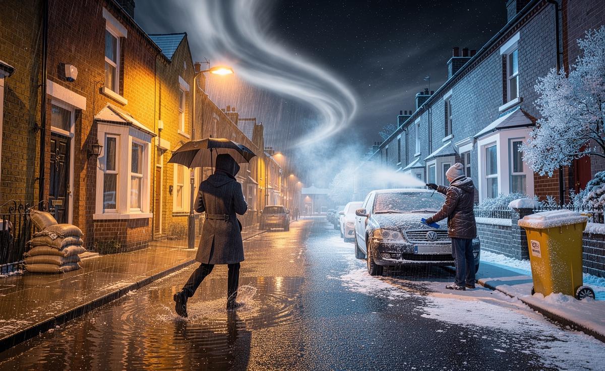
This winter has already begun to feel uncanny in the UK: bursts of spring-like mildness are punctuated by sudden snaps of bitter cold, and rain systems arrive in conveyor belts rather than gentle fronts. Meteorologists describe it as a season of heightened volatility, where small nudges in pressure and wind can tip the country from soggy commutes to blocked roads overnight. In short, it is not just “warmer or colder than average”, but a faster switching between regimes. As a reporter who has waded riverbanks and tracked the jet stream on deadline, I’ve learned that the headline isn’t simply temperature—it’s the choreography of air, ocean, and land. Here’s what that dance looks like now, and what to watch.
Why This Winter May Feel So Unstable
The UK sits at a crossroads of weather highways. When the Atlantic jet stream is strong and aimed at us, we get a parade of mild, wet lows. When high pressure blocks to our north or east, the tap turns and we can inhale air from Scandinavia or the Arctic. That blocking—especially if reinforced by a Sudden Stratospheric Warming event—can flip us from umbrellas to ice scrapers in 36 hours. Add unusually warm North Atlantic sea surface temperatures and residual energy from global heat records, and the atmosphere has more fuel for intense rainfall.
Forecasters track the North Atlantic Oscillation (NAO) and hints of stratospheric disruption to gauge these flips. A negative NAO favours colder, drier spells with increased frost and snow risk away from coasts; a positive NAO loads the dice for wind and rain. The twist this year is persistence: recent winters have lingered in one regime, then lurched to the other. In the field, that means salt barns run hot for a week, then sit idle while flood pumps take over. Small shifts in the jet’s latitude can mean the difference between balmy rain in the South and disruptive snow on the Pennines.
Signals To Watch Week by Week
Long-range forecasts offer probabilities, not prophecies. So we translate them into trackable signals—clues that help households and councils move early rather than react late. Think of these as dashboard lights, not guarantees.
| Signal | What To Watch |
|---|---|
| NAO Index | Trending negative for several days can raise UK cold risk; sustained positive favours wind and rain. |
| Stratosphere (10 hPa winds) | Weakening polar vortex or warming events can disrupt patterns 1–3 weeks later. |
| Jet Stream Track | South-shifted jet boosts storm and flood risk for England/Wales; north-shifted favours Scotland/N. Ireland impacts. |
| Sea Surface Temperatures | Warmer Atlantic can add moisture, intensifying rainfall totals in strong frontal systems. |
Practical translation for the week ahead:
- If lows line up southwest–northeast, prepare for “rain-on-saturated-ground” flooding and landslip risk along transport corridors.
- If high pressure blooms over Greenland, grit early: radiative cooling can deliver sharp frosts and freezing fog inland.
- When dew points plunge below 0°C with precipitation nearby, model snow lines drop quickly—watch elevations above 150–300 m first.
From a newsroom perspective, I pair ensemble guidance with river telemetry: when ensembles cluster around a stormy outcome and gauges rise overnight, that’s my cue to call local resilience forums. By the time the yellow warning appears, the best preparation window may be closing.
Real-World Impacts and How To Prepare
The shock this winter isn’t only the weather; it’s the speed with which impacts compound. Rail and road networks are sensitive to both water and ice. Farmers juggle saturated fields and brief cold snaps that stress livestock. Energy demand whipsaws, nudging bills higher during cold bursts even if monthly averages look “mild”. Volatility, not extremes alone, is what strains systems.
Pros vs. Cons of a milder, wetter winter:
- Pros: Lower heating demand on average; reduced burst-pipe incidents; fewer prolonged snow closures.
- Cons: Elevated flood risk; soil erosion; mould and damp in housing; increased storm-related power cuts.
Preparation that pays off:
- Households: Clear gutters, test sump pumps, stock rock salt, and keep a torch and power bank. Photograph home inventory for insurance.
- Councils: Pre-position portable pumps; prioritise gully clearance on known choke points; align grit runs with hospital and bus routes.
- Communities: Volunteer flood wardens, WhatsApp groups for road conditions, and shared thermal spaces for vulnerable neighbours.
On a reporting trip in the Calder Valley, I watched residents place inexpensive water alarms in basements; a 3 a.m. chirp bought them 20 minutes to move valuables upstairs. Early, small actions turn a “shocking” winter into a manageable one. In practice, resilience is a chain of modest, well-timed decisions rather than a single grand fix.
Shocking weather does not have to mean shocking losses. The science points to a winter that pivots—sometimes abruptly—between soggy Atlantic pulses and crisp, blocked interludes. If we watch the signals and prepare for both, we can protect homes, budgets, and routines while keeping a wary eye on the river outside and the frost on the windscreen. What pattern are you seeing on your own street—water creeping up the kerb, or rime forming on the bins—and how will you prepare for the next switch?
Did you like it?4.6/5 (21)
